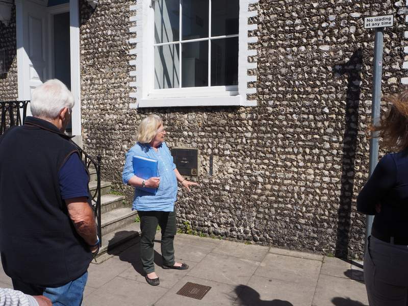
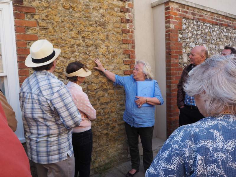
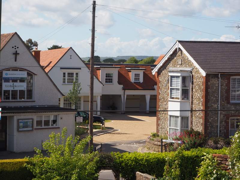
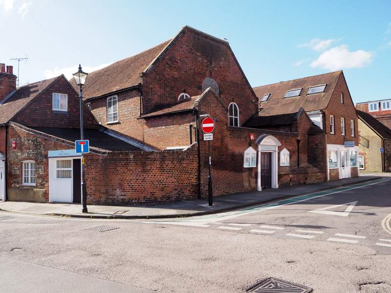
Chichester’s earliest inns can be traced back to mediaeval times when they catered for pilgrims visiting the shrine of St Richard in the cathedral. Over time they came to serve all types of travellers, who needed rest and food after travelling along the notoriously bad Sussex roads. By the middle of the seventeenth century there were seven inns in Chichester, as well as 50 alehouses, taverns, and other premises that sold drink. Given the population was only 2,000 people at the time, of whom over half were women and children, it can be seen that Chichester was a boozy city. The naturalist, W.H.Hudson, was horrified to find ‘drink-degraded wretches’ sprawling on the street corners in sight of the cathedral spire – a sight that appalled him.
Sadly, the city has seen many of its hostelries close in recent years and this trail includes some of these. The Swan, The Royal Arms, and The Fleece, are three prominent inns that have closed in East Street alone. Fortunately, many others still survive, including, The Fountain, The Hole-in-the Wall, and The Old Cross. Today there are only a dozen public houses in the city centre and no inns. Many of the city’s old inns have been converted into restaurants or private accommodation. This trail includes both former as well as current pubs and inns. Download it here.
For details of other trails and where to obtain the leaflets see here.
Society Chairman Richard Childs explains the Society’s wish-list
In March the Chichester Society responded to a consultation on the District Council’s Vision for the city centre over the next 20 years. Our response can be seen in full on the website. This article is a summary of that vision.
We feel that as the main entry points to the city centre, it is vitally important to improve the four gateways. So looking at each in turn our thoughts are as follows:
Northgate We believe the Northgate gyratory should be abolished and an attractively designed hotel built on the footprint of Metro House. A signal-controlled pedestrian/cycle route on a line from St Paul’s Road to North Street would be of immense benefit to everyone, notably residents.
Redesign Northgate car park to provide a landscaped walkway from Oaklands Way to the Theatre, enhanced with low level bollard lighting. This walkway would be orientated and focused north towards the theatre and south to the Cathedral spire. A signal-controlled pedestrian/cycle junction is required for crossing Oaklands Way, thereby providing a popular alternative to the pedestrian tunnel.
Southgate Again, we believe that this gyratory ought to be abolished and the northern leg made for two-way traffic. The Crown Court has enormous potential for conversion to a multi-use venue but primarily as a concert hall. The vast spaces of the bus garage would be ideal for large scale gigs. Everyone recognises the canal basin’s scope for regeneration and we support a variety of leisure uses for this location: an hotel, bars and restaurants with landscaped terraces fronting onto the canal. No structures should obscure views of the cathedral and its spire. Create a purpose-designed ‘gateway’ feature at the location of the former South Gate. Move the bus station north of the railway as part of the existing station forecourt. Is this the moment to mention the elephant in the room? The reason for increasing traffic congestion in this neighbourhood is the railway. Why not commission a feasibility-study as one element of a Southgate master plan to provide road bridges in place of the two level crossings?
Westgate We would like to see a landscaped garden on part or all of the Orchard Street car park. This amenity would be some compensation for the anticipated loss of Westgate roundabout due to highway works associated with the Whitehouse Farm development. Nearby, the untapped potential use of the Cathedral Green can be explored. For example, create several ramps between the raised footpath and West Street – a feature that would be popular with wheelchair users. Remove the diseased lime trees over time and replant. Retain bus stops but place two heritage-type bus shelters outside former Post Office.
Eastgate This gyratory should also be abolished. We would make St Pancras and The Needlemakers two-way. We would pedestrianise The Hornet to create a quirky shopping quarter on the lines of those in Brighton or Lewes, all of which are flourishing with small traders since pedestrianisation projects. Kwik Fit must be relocated to the city periphery and in its place developed retail space for small units from St Pancras through to The Hornet. Small retail units would fit well on the North and/or East side of the Cattle Market car park. Parts of this substantial area could become a covered market, of the kind seen in almost all French towns. Such buildings can be extremely attractive.
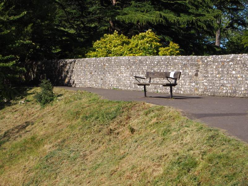
The City’s Night Time Economy – adding pizzazz We would like to see the city centre become even more attractive through imaginative floodlighting. This would focus on the principal elements of the city’s urban character: buildings like the Council House, the Guildhall, St Olaves Church, former Corn Exchange, St Pancras Church and St John’s Chapel; but also historic structures such as the City Walls at Jubilee Park and Westgate Fields, or the Bell Tower & St Peter the Great, or the Gateway to Canon Lane. This city could become famous for its ‘lighting festival’ timed during the Christmas season and the Festival of Chichester in June-July.
Increasing City Centre Accommodation Proactive policies and programmes can encourage owners of retail and office space to develop surplus accommodation, ideally for flats or small business units.
Protecting Chichester’s Special Character Chichester’s “Special Character” owes much to its rural setting and rural features of much of this city. These aspects need greater acknowledgement and protection possibly through the medium of existing design guides. For example: hedges rather than fences, wooden street furniture rather than big-city steel and plastic. Planning policy should seek to “knit together” the street scene, without too many stand-out, statement buildings. New buildings within the city centre should aim to be quietly sympathetic rather than shouting for attention. But even where the occasional “statement building” is permitted it must be sensitive to its neighbours.
And finally, the Society would like to
Improve the appalling state of the city centre’s pavements.
Provide a high quality Tourist Information Centre in North Street under the Council Chamber with glazing in the arches.
Use architectural competitions for larger development sites to ensure high quality design.
Provide more seats in the city centre, particularly in South Street and Southgate.
Re-open public toilets that have been closed in recent years.
Could any of these aspirations come to fruition in years to come? While recognising the constraints, not least finance, we can hope – and indeed this is why the District Council has sponsored such a wide ranging public consultation. Hope. An important word; there’s even a website dedicated to poetry with hope!
(This article and the following comment originally appeared in the June 2017 issue of the Society’s Newsletter)
WHAT’S NEXT?
Steve Oates, CDC Economic Development Manager and Chichester Vision Project Manager, comments: “We received a strong response to our six week public consultation. Subject to any further amendments, it’s anticipated the final Vision will be adopted by Chichester District Council, West Sussex County Council, Chichester City Council and Chichester BID during July. From that point the work really begins! A delivery plan and team will be formed to ensure the aspirations and ambitions set out in the Vision become reality over the next couple of decades”.
An impression of Little London car park with a purpose built outdoor market area and open amenity space (Image: Chichester District Council, ‘Chichester Tomorrow… A Vision for Chichester’)
The Pallants are an ancient area in Chichester. Originally known as the Palatine (of the palace) these four streets belonged to the Archbishop of Canterbury and this situation persisted until the nineteenth century.
The Four Pallant Streets
In medieval times it was an area of commerce with many malt houses and other merchant properties. In 1724 Daniel Defoe wrote that Chichester was “not a place of much trade, nor is it very populous”, having a population of just 400 souls. The eighteenth century though was a time of expansion and much of the town was re-built in brick giving birth to a flourishing brick industry. In this century many of the houses in the Pallants became “gentrified”, some being completely re-built and others leaving a timber structural frame to be clad in brick according to the Georgian fashion.
The view presented today is that of a fine Georgian street but this hides the much earlier beginnings of the streets. In particular 9 West Pallant, sporting a handsome Georgian façade dates back to the early Tudor period and internally there is much to remind one of this. After the last war many of these wonderful buildings were listed Grade II to ensure that they are preserved. In recent years there has been a tendency for the commercial occupiers to move from the area and this has led to many houses reverting to residential use.
Today most of the houses are in residential use and they certainly make elegant homes which are a delight to the eye. However, with elegance comes responsibility. In effect the owner of a listed building becomes a caretaker of the heritage. Unlike many ordinary properties where the building might be extended without planning permission under the Permitted Development rules if you are the proud owner of a listed building the size of the planning dossier can become quite daunting. For almost every alteration no matter how small and application for Listed Building consent is required which includes a Heritage statement and a Design and Access statement. In addition you may well also need planning consent. The Pallants are of course within a conservation area, so account is taken of the effect of any alterations on the surrounding area. So plenty of pitfalls and professional advice is seriously recommended.
By way of illustration I give by way of example a project in West Wales with which I have been involved and which was recently the subject of a Restoration Man programme on Channel 4. This particular project was unusual in that it involved both a listed building and a scheduled ancient monument. Another fly in the ointment of this project was that over the thirty or so years it took to complete the project legislation changed and rules were altered.
Thirty years ago my client bought a gazebo which had been built on top of a medieval tower forming part of the town walls in Pembroke. The gazebo and the surrounding piece of garden had once formed part of an elegant 18th century house on the high street but which had been separated because the owners lacked the means to restore the gazebo.
The 18th Century Gazebo
The gazebo was in a ruinous state and the accommodation, which it offered, was limited to one room on each of the two floors. In order to make the property useable it would be necessary to extend it. So plans were drawn up and we consulted with CADW (the Welsh equivalent of English Heritage). After several visits and much discussion CADW gave their blessing and we applied for planning permission which was eventually granted with many conditions. With paperwork secure we employed a contractor to commence the works. Because of the existing town walls (which we were not allowed to touch) everything for the work had to be craned over the wall. All went well to start with and much of the structure for the new extension was completed. Then disaster struck. After three months the contractor suddenly went bankrupt bringing the work to a sudden halt. My client was quite distressed by this turn of event s was so fed up that he walked away from the project.
Unfinished business
A hiatus of over two decades ensued before I received, quite out of the blue, a phone call from my client suggesting that as he was now retired it might be a good time to resurrect this project.
Early in 2014 the documents for the project were retrieved from the archives and dusted off. Over the intervening years my client had had time to think more about the project and some changes were necessary which involved Planning applications and Listed Building consent. In the meantime the construction drawings were prepared and a new contractor engaged to carry out the works. So far so good.
The only way to deliver materials
By April 2014 the contractor had been on site for several weeks when one morning a lady from CADW turned up on site and told us that we must cease work immediately as we did not have planning permission for the work which we were undertaking!
The lady from CADW explained that although we had all the correct planning consents including Listed Building consent for the 18th century gazebo we had no consents for the medieval tower on which it sits. For this we needed to apply for Scheduled Ancient Monument consent. I did point out that the work which affected the medieval tower had been carried out thirty years previously. My pleas fell on deaf ears. We would have to apply for ancient monument consent which she said, had we applied for it thirty years previously it would have been refused! My response was that in that case she would have no alternative but to refuse consent following which my client would involve CADW in a very costly lawsuit. After several months permission was granted but with a rider that CADW did not approve of what we were doing.
Despite the amazing tangle of planning paperwork the project was successfully completed in 2015, although it has to be said that there were two zeros on the contract price compared with the original contract.
Worth it in the end!
The moral of the story is that it is a wonderful experience to own a listed building – but never do anything without sound advice.
We speak with Chairman Colin Hicks about the Business Improvement District
Newsletter readers may remember Chichester’s BID received a boost just before last Christmas. A ballot among city centre retailers and other business resulted in a clear majority in favour of BID continuing its work to improve the city centre for everyone. On this hopeful foundation BID’s management board has been taking stock of its contribution to Chichester life.
The Chichester BID – some background
Business Improvement Districts, or more simply BIDs, are partnerships between all the organisations and individuals who want lively and successful city and town centres. They started in Canada over 40 years ago, came to Britain in 2004 and began at Chichester in 2012. This is because BIDs are regarded as making a positive difference, injecting management and money to build a hopeful future. BIDs are funded by a levy on those paying non-domestic rates. They must be agreed by a ballot of local businesses and are renewed every five years. That’s why there was a ballot in Chichester last autumn: the first five years – BID 1 – had expired. The numbers involved are perhaps surprising: in the Chichester BID area (within the City Walls) are over 700 businesses: about half are retail (shops) and a fifth offer food or drink; the rest provide commercial and inter-business services.
What has Chichester’s BID achieved?
Most obviously, the Christmas lights! The 2016 switch-on attracted our largest crowd ever. Less obvious are the many behind-the-scene activities to increase the city centre’s viability. For example, installing new digital ‘footflow’ counters to monitor ‘people movement’ – knowing whether numbers are rising or falling is important. The BID also promotes Chichester and its events and attractions by regional advertising to encourage visitors. When they arrive we help them get orientated. Have you noticed the many map boards in car parks? They are there because of BID. And have you noticed the leaflet-style street maps in purpose-designed dispensers around the city centre? BID printed 150,000. It’s a small thing, but a free street map can be really helpful to visitors. A last example of behind-the-scenes efforts is improving the city centre’s security – it’s called Chichester Businesses Against Crime (ChiBAC) and has been quietly successful.
One of Chichester BID’s initiatives is to use flags to enliven the street-scene (Photo: Chichester BID)
Chichester’s city centre is changing
It will not have escaped your notice that pedestrian streets everywhere are changing. Shopping is migrating to the Internet which now accounts for some 17% of UK retail spending. So there are fewer shoppers on the nation’s high streets, Chichester included. But those still coming seek other opportunities whilst in town: coffee, a meal, visit an exhibition; take a stroll around the park. This is a shopping experience you cannot get on the Internet: knowledgeable personal service often from an independent retailer, the chance to try on clothes, an impulse buy at the farmers’ market.
Keep those tills ringing!
Chichester has plenty to offer residents’ and visitors’ changing habits and tastes. In retail jargon this city is a ‘multiple shopping destination’ but it’s also a town with a successful University and College; and it’s alive with arts, culture and heritage of national importance. Over the next five years 2017-22 the BID 2 team will continue to maintain partnerships with local government and others like the Chamber of Commerce and Visit Chichester. The BID’s task is straightforward: to increase the city centre’s viability and keep those tills ringing!
(This article appears in the June 2017 Society Newsletter – join the Society to receive this Newsletter and enjoy other benefits)
Ken Rimell relates a disturbing story of what we might have deployed if the invasion faltered
This story emerged several years ago from a reliable source. It seemed at the time that the end result would have been catastrophic to say the least, had it taken place, but my source was adamant that it was true.
The planning for D-Day in 1944 took many avenues for it to succeed, the allies had taken almost everything into consideration for its ultimate result, but for two major factors, the weather and the throwing back of the allies into the waters of the Normandy beaches, and operation Overlord grinding to a halt with a massive loss life. The story came out during a reunion of Hawker Typhoon pilots in the late 1980’s when one of the pilots, a former Wing Commander, mentioned there was an ‘alternative’ solution had the day fared badly for the liberating forces. Typical of these reunions it was after a few drinks that these pilots could recall those days sharing them in the knowledge it was with fellow airmen in a convivial atmosphere, but this story has a certain credibility, and not a line shoot.
Typhoons at RAF Selsey 1943
Operation Overlord was the name given to the beginning of the liberation of France, with landings all along the Normandy Coastline by the allied forces, the strategic planning, carried out at two major locations here in the south with Southwark House, just north of Fareham, dealing with the ground forces attack while a few miles away in Chichester at what was once Bishop Otter College, the airborne assault was directed. This location was ideal for there were so many airfields in the area, nine at one point, packed with fighters and fighter bombers. During the run up to D-Day and from mid 1943 ALG’s were built (Advanced Landing Grounds) in the area, where runways were made of a special metal sheeting known as either bar and rod or summerfelt tracking. These were capable of coping with the weight of such aircraft as Typhoons, Spitfires, Mustangs . The panels were easily put into place, pinned with spikes and supported with the rapid growth of grass passing through the metal holes, thus holding the runways firmly in place. This story will deal with the Hawker Typhoon and the squadrons in our area operating from some of these makeshift landing grounds at the crucial time of war.
Villages such as Apuldram, Funtington, Selsey, Westhampnett and Bognor, were soon home to the airfields that housed these squadrons adding to the list of the more permanent airfields such as Tangmere, Ford, Thorney Island, Merston, that were already well established. Operating from the south coast region meant the Typhoons flying time over enemy territory would be greatly extended, and even further with the addition of extra fuel tanks that could be jettisoned should the need arise. It was these extra fuel tanks, teardrop in shape, that was to cause a major concern at one of the airfields here in the south.
It was in the winter of 1943/44 that a large deep pit was dug at one of these airfields and cordoned off. Speculation that the hole was to be an Emergency Water Supply, were soon dispelled when a fleet of RAF lorries complete with a large RAF guard appeared early one evening and ushered any peeking eyes well away. One eyewitness, who had escaped the security order noted a huge number of these fuel tanks were strapped to the lorries cargo area. In the ensuing hours and well into the dark the job of offloading this cargo went on and lowering gently into the pit. By morning the hole and its cargo was covered by earth, but still cordoned off. According to the story these drop tanks didn’t contain fuel but were filled with the deadly mustard gas, a safeguard should the allied landings show signs of failing and an order directly from the War Office to drop them on the enemy was tasked to one Typhoon squadron.
Drop tanks on Typhoon
To a degree I overlooked the matter for several years but at a following reunion some time later my informant hove into view, the intervening years had seen the onset of what looked like dementia, so my appeal for more information, from this now elderly gentleman on this extraordinary claim was met with a blank expression, or was it that he didn’t want to elaborate further? While the story is quite feasible I wanted to know which airfield here in the south housed that deadly cargo and was it ever recovered after the war, but my question was unanswered and the mystery remained.
Driving past the former airfield at Merston in the late 1980’s I spotted a team of military personnel in the centre with heavy plant and machinery. I wandered over to see what was happening and found it was an army bomb disposal unit tasked with removing wartime pipe mines on the runway intersections. These mines were buried so that in the event of an invasion the runways could be blown up and prevent their use by an enemy force. The commander in charge told me that they were making sure that the Canadian forces, tasked with the job in 1946, had in fact done the clearing properly. Not knowing which airfield held that deadly gas pile I mentioned this to the army commander and after setting off charges to destroy several long sticks of pipe mines that had been overlooked in 1946, they went off in search of this noxious and deadly substance, but nothing was found. The same applied when pipe mines were dealt with at airfields at Tangmere, Thorney Island and Ford leaving other airfields, such as the ALG’s, that didn’t have pipe mines to be not searched by the army bomb disposal teams that may still house this terrible weapon.
To me this story has a certain credibility, with such few people being involved with its possible application at government level it could be true, on the other hand it could be a good story dreamt up by a retired RAF Officer to fuel the ever expanding myth about special wartime activities, a sort of James Bond. But the look in his eyes when telling the story, and in some detail, there was a ring of truth in what he was saying. The fuel drop tanks fitted to fighter and fighter bomber aircraft at the time were made of either light metal or, to save vital metal, of papier mâché, a glue impregnated paper. How they were prepared for storage underground at this mystery location is unknown, whether they were removed as secretly as they arrived and destroyed after the war is also unknown, leaving speculation that they might even be still lurking deep in a Sussex field. Thankfully they were never used in anger and the allies secured a foothold in France and on to victory, but the thought of their use sends a shiver down my spine at the outcome had push come to shove, more so if they are still evident somewhere in a Sussex field!
This article originally appeared in Sussex Views May 2017 and is reproduced with the kind permission of the author.
Ideas for Chichester’s bypass are trapped in the 1970s says Bill Sharp: we need a radical rethink.
Where Are We Now?
The various plans for the A7 bypass round Chichester were all recently pulled by the secretary of state. For some this comes as a blessed relief, because it gives breathing space for serious thought about how we could do things far better.
None of the proposals was a roaring success. Homes demolished (one a listed building), fly-overs hard against windows, fields and views ruined, and wildlife gone.
Roe Deer (Wildlife habitats are threatened by all the options. But particularly by what was the front runner; the new road across the southern fields in Option 2) Photo Courtesy Brian Fellows
Then there’s the cost – between £47 and £280 million – much from funds levied from housing developers and supposed to benefit locals impacted by the new housing.
You might think that the first call would be on re-financing services our local councils are struggling to provide, following repeat slashing of central-government funding in recent years. Things like libraries, citizens’ advice bureaux, health and social services and public transport, not to mention our schools so stretched that they’ve launched the county-wide “WorthLess?” campaign.
All these services are being pushed ever closer to breaking point by the growing population wished on us from on high. But instead the lion’s share of funding has been earmarked for this blight on lives and landscape. Not just that, rubbing salt into the wound, County and District councils specifically asked to downgrade locals by prioritising through-traffic. So those living to the east would lose their direct route across the A27 and literally be “sent round the houses”, while those to the south, on the Manhood Peninsula, faced “no right turns” designed to relieve A27 congestion by, er, diverting more traffic onto it.
Fields to the South – Earmarked for a relief road in Option 2. But surely better preserved for local quiet recreation and tourism. (Photo Bill Sharp)
No wonder the local reception was chilly: from the County Council’s unenthusiastic ‘commentary’ to uproar across the Peninsula. Yet, for all the destruction and cost, not a single option offered more than a short-lived sticking plaster. Whichever was chosen, the roads were predicted to clog up again no later than 2035.
The reason? Induced demand. You just can’t build yourself out of congestion. As we’ve seen with the M25, if you build it, they will come. In the short term, if you free up the roads, people simply make more “discretionary journeys”. In the longer term, people move out to nicer places where the commute now covers many more miles but magically takes the same time as before. And, inevitably, developers too come and build houses in places that used to be inaccessible.
The now withdrawn proposals split the community too. In the north, the “Chichester Deserves Better” campaign came together to call for the blight to be dumped in the south; without a thought for “Turner’s View” across canal to distant cathedral.
Rowing North of Hunston (Did Highways England stop to consider how a concrete bridge would discourage trips on foot and by bike – and even boat) (Photo Courtesy Chichester Canal Trust)
For their part, the south responded with “Better for Chichester”, calling for a northern bypass that would rip through the rolling fields that inspired Blake’s Jerusalem.
Meanwhile, each of the options tears into existing green routes. Wherever a footpath or cycleway is reworked, it’s invariably worse. The well-used Bognor Road foot/cycle bridge is even removed completely! And how will a roaring fly-over keep the canal path a more attractive choice than the car?
Depressingly, the largest roads budget since the seventies comes with a mindset stuck in the seventies, when similar car-centred thoughtlessness created similar blight and short-term fixes and, as an unintended consequence, saw walking and cycling levels plummet and sedentary lifestyles rise, with disastrous effects on the nation’s health.
How did we get here?
The problems that brought us here are two fold. Firstly there’s the fixation on economic growth. At the District planning meeting, Councillors and officers alike tirelessly repeated the mantra of “the economic growth we want” despite a room-full of protesters saying “not at this price” and despite local businesses – from shops to the Canal Trust, a farmer and a riding school – contradicting the Chamber of Commerce respondents (all 11 of them), and saying that all the plans would anyway leave them worse off … if they survived in business at all.
Compounding the situation, those in our corridors of power seem wedded to macho ‘hard development’: outsized sheds, pack-houses, warehouses and housing estates that could be anywhere. Much like the bland “anywhere towns” that we suddenly discovered we had sleepwalked into a few years back. There’s scant acknowledgement that such featureless development erases Chichester district’s “special character” – supposedly protected by its Local Plan – or that this special character is precisely what gives the district its keenest economic edge. What the marketers like to call its ‘distinctive offer’ comes not just from pretty Georgian buildings but also the city’s compact size, walkability and easy access to its rural setting and quiet informal recreation – without first having to jump into a car.
We should be stressing the quality of life and prosperity this brings, not growth for growth’s sake. But even if we must go for growth, we’ve reached a fork in the road. We can continue to urbanise this rural district piece by little piece, and pretend we don’t realize what’s happening. Or we could go for ‘soft development’, harnessing the quality of life to attract those who appreciate what’s already here. The likes of software designers, website creators, authors, artists and designers – who don’t need to commute every day, and send their wares down wires not roads. This, incidentally, would also help re-balance the economy from over-reliance on agriculture – which is anyway becoming increasingly automated.
We could also attract more tourists, as recently recommended in a District Council report. And if it’s tourist growth we want, it’s baffling that Chichester has not latched on to the Centurion Way like Cornwall did the Camel Trail which some years ago was estimated to contribute around £3 million annually to the Cornish economy – and, unexpectedly, turned out to be one of Cornwall’s few year-round draws.
It’s equally baffling why no-one acknowledges how badly the Whitehouse Farm development will sterilize the potential for the Centurion Way (and hence Chichester generally) to act as a “green gateway” to the South Downs National Park, let alone that a northern bypass would scotch that potential completely.
Whitehouse Farm from Centurion Way. The Planning Inspector for the South Downs Park commented that this landscape “of high scenic quality” contains “a mosaic of woodland, parkland and pasture” with “a network of quiet lanes, bridleways and footpaths that provide important open-air recreational opportunities” – So let’s build houses on it! (Photo Bill Sharp)
The inconvenient truth here is that roads can suck away as much as they bring in. What drives one form of development, drives away another.
We’ve had one local example of the wisdom of holding out against doing the “obvious” thing that everyone else is doing. Namely West Wittering beach. In the twenties, while everyone else was “developing” the coast, in the Witterings they did … well precious little. And now the atmosphere and “special character” of the beach and its setting make it one of the south coast’s prime attractions. It’s a nice earner for the shareholders too. This long-term thinking has ultimately far outperformed the fast buck attitude that would have had the fields there turned into houses.
We’ve also had a more recent warning about trying to have our cake and eat it, about mixing “special” with “anywhere”. In 2014, Rolls Royce commented on a proposal for their neighbouring fields, saying ‘Rolls Royce will effectively be located within a housing estate that is indistinguishable from any UK urban location; exactly the situation we sought hard to avoid’.
It’s easy to have ‘issues’ with special pleading from a car factory plonked in green fields, however mossy the roof. But it’s also easy to see that a company like Rolls Royce wouldn’t have come here if we’d already had ‘anywhere development’ scattered around, and that, if we continue making self-inflicted wounds, they might eventually make good their veiled threat to move on. And neither tourists nor low-impact businesses will find much distinctive to attract them here either.
Ultimately, if you try “special” and it doesn’t work you can always try “anywhere”. If you deploy “anywhere” first, there’s no plan B.
The other half of the “two-fold problem” lies in Highways England’s narrow remit. If you only have a hammer, everything looks like a nail. If you run a roads problem past Highways, all solutions look like roadworks. So now all options focus on speeding up A27 traffic, albeit by a few minutes at most, and all singly fail to deliver other government policies – public transport, walking and cycling, and home working.
Is the best on offer really roads which, if uglier, at least flow no worse than before … for a few years?
Where could we go instead?
Let’s ponder if a similar amount of money to what’s on the table could be used to more lasting benefit. Some ideas follow. A number require a degree of subsidy, which to some is a dirty word. But the massive road-building budget that we have somehow found in the midst of a recession is, in effect, a huge subsidy to commuters over home-workers, and to the private motor vehicle to the detriment of almost all other forms of transport, and this subsidy indefensibly ends up propping up road-reliant businesses against those – like the Canal Trust, the shops, farm and Riding School – which are positively better off without road intensification.
So why not instead consider spending the money on:
Park and Ride Both the County and the District Council failed to ask Highways to investigate P&R. So we just don’t know how much P&R might help ease the congestion.
A pod soaring above congestion. An obvious candidate for a modern shuttle bus from Park and Ride into town (Photo Courtesy Ultraglobal)
New Selsey Tram Today’s congestion could be vastly reduced by a modern version of the tram. Namely a dedicated route for local journeys, requiring just one A27 underpass (or bridge) to
Manchester’s Metroline tram service at Piccadilly Gardens. (Photo with thanks to David Bosher, courtesy of Gareth Prior and British Trams Online)
completely do away with the existing cross-traffic conflict. (In an indictment of our short-sighted planning system, some of the old route has disappeared under “economic growth”, but alternatives remain to keep the idea viable.)
Driverless Pods The pods currently shuffling around Heathrow Airport are soon to be trialled on the streets of Greenwich, Bristol, Coventry and Milton Keynes. Why not Chichester next? Running the route of the “New Selsey Tram”,
Pod seen here on their Cardiff test track (Photo Courtesy Ultraglobal )
or as modern shuttles for the park and ride. (Since pods have no drivers, they have a lower staffing cost than conventional P&R. Better still, in a well-run system there’s no wait for the bus, there’s always a line of pods waiting when you want one. Also, since they drive themselves away to where they are next needed, they require no extra parking space in town.)
Smarter New Developments Developers spend huge amounts to simply rework surrounding roads (often, like at Whitehouse Farm, reworked for the benefit of cars and at the expense of even existing quiet walking and cycling routes). Why not instead fund car clubs (or soon “pod clubs”). And why not re-allocate finances for better on-site facilities like doctor’s surgeries, community shops, sports areas, after-schools clubs and community halls, which reduce the need to travel in the first place and ensure more social interaction and vibrancy on site?
Building on City Centre Car Parks instead of on far-flung green fields. This again eases the roads by reducing the need to travel, and is suggested in the Cathedral Cities in Peril report by the Foster Partnership and English Heritage (2015). The idea needs caution, but if the alternative is millions of pounds on a temporary fix?
Goods Consolidation Centre The recent Road Space Audit suggests this idea, which involves consolidating freight into smaller vehicles for “last leg” deliveries. Unloading from one vehicle and re-loading onto another inevitably creates inefficiencies that hauliers don’t relish. But overall efficiency is increased as large lorries don’t spend forever sitting in congestion, and contributing to congestion, just to drop off a small fraction of their overall load. Consolidation centres on a city’s edge also allow “just in time” delivery to the city centre, which finally allows the centre’s shops to fight back against what suddenly seem relatively slow delivery speeds of the Internet.
Green Infrastructure The Selsey road is positively dangerous. The problems here are just as pressing as on the A27. Residents have been campaigning for a safe cycle route for over two decades. They’ve recently had it costed … at roughly the price of a single roundabout on the A27! Infrastructure like the Selsey Greenway can greatly reduce motorised traffic on and off the Manhood Peninsula. More so now than ever before, given the arrival of electric bikes. There’s also the potential to stimulate low-impact tourism. But where’s the political will?
Green Infrastructure (Contd.) In countries such as Holland, it’s standard to put a cycle path alongside any new stretch of roadworks. The marginal cost is minimal given that workers and machinery are on site anyway. Again, with electric bikes, the rationale for doing this is greater than ever. But, here too, this country has yet to move on from the seventies.
Vauban – A new development in Germany – downplaying the car so that quality of life can break through (Photo Courtesy www.vauban.de/en)
Wait for Future Trends Driverless Pods have already been mentioned, but the future almost certainly also lies with driverless cars and driverless lorries. When reviewing traffic and parking in the city centre, the Road Space Audit finished by recommending a “wait and see approach” precisely because future changes are unclear but, at the same time, likely imminent and radical. It would be smart to adopt the same approach for the A27. After all it would be pretty ironic (not to mention an epic waste of money) if, after all the blight and expense, it turns out that “platooning” of lorries allows us to squeeze more freight into the same road space, and that platooned or driverless lorries allow far more freight to be transported outside peak hours, when the A27 still has massive spare capacity. And, irony of ironies, what if autonomous cars mean that in the near future it is actually more efficient to get stuck in congestion, as you can then spend a bit more time working in your car, which doubles as your mobile office (or even as your gym).
Traffic Smoothing While waiting to see what the future brings, there is one line of attack that’s so comparatively cheap and straightforward that we could try it immediately. And that’s traffic smoothing. Some drivers have commented “It’s not the speed of my journey, it’s the predictability that matters to me“. In some areas, such as parts of Bristol, the dual carriageway is limited to 50 mph – which increases car-carrying capacity. Such speeds also lead to less stop-start movements and hence immediately less pollution. In addition it seems likely that, on the A27, traffic-light timings could be set to send traffic along the road in pulses, leaving gaps for similarly pulsed North-South traffic. Pulsing works with cars in New York and bicycles in Copenhagen. Admittedly, the winding A27 is less straightforward than the grid pattern of New York, but it still has few enough junctions that the idea is likely workable. And that would be the “intractable” A27 problem largely solved, for slightly less than £280 million. The main problem seems to be lack of the necessary modelling expertise within Highways England, and lack of interest in sourcing the expertise from elsewhere. Far easier to “just get on with doing what we’ve always done”.
Incentives to think outside the box If we can combine some of the above to solve the A27 problems for less than a middling figure between the lowest and the highest cost options, say a “modest” £100 million, then the money saved should be divided up, with half going back to the DfT and half going to our local councils. That should provide incentive to think differently, and move on from the mentality that forgets to reinstate pedestrian bridges and regards green infrastructure generally as an afterthought instead of a key part of the solution. The windfall would buy a lot of school equipment, mental health services or what have you. If we had more joined-up government (remember that?), the windfall could even pay to preserve our disappearing Law Courts – so avoiding the farce of one government department tearing its hair out about how to solve congestion on the roads and overcrowding on trains, while another department puts more strain on those same roads and trains by converting journeys, that for many used to be a stroll across town, into long-distance trips to Portsmouth, Brighton or even Hastings.
Going Dutch If we must have “grade separation”, better to bury the road than raise it. Visual intrusion is less, and so is noise carry. And don’t let anyone say that the water table is an intractable problem. It wasn’t for the Dutch at the Veluwemeer Aqueduct (which carries boats from one side of the road to the other). Note also the cycle path alongside the road – as a matter of course
The Veluwemeer Aqueduct (Photo from Wikipedia )
Are these ideas pie in the sky? We’ll never know, because Highways England wasn’t asked to investigate anything other than roadworks, so guaranteeing that we get “improvements” that are short term – and in just over 15 years we will have to plough more money better spent elsewhere into yet more roadworks – funded by yet more blight. That’s a vicious cycle well worth stopping in its tracks.
Is there light at the end of the tunnel?
It was claimed earlier that the problem is two-fold. In fact it is three fold. The third problem is ourselves. If anything of lasting benefit is to emerge from the present mess, we must do more than suggest clever ideas for other peoples’ travel choices. We must take a hard look at our own. Can Chichester rise to the challenge? It definitely can. But for that to happen, we must all come together to call for smarter options. The northerners must stop calling for the trashing of Turner’s View, and the Southerners for the ripping up of Blake’s “pleasant pastures”.
Since the original plans were pulled, strong promise of a new beginning has come in the initiative from County Council to try to pull all sections of the community together in a series of workshops.
That said, there’s more than a hint that seventies thinking is still strong when the name of this new initiative is “Build a Better A27”, and when, at the first meeting, passionate voices still called to “dump it in the north” or “dump it in the south”, depending on where they live.
To encourage more flexibility and dialogue between the die-hards, it’s worth pointing out that, under the present growth agenda, if southerners do get a northern bypass, their now more accessible fields, vistas, walks and wildlife will be ripe to fall to more sheds and housing than ever they imagine. While if northerners hold the line to the south, the road will clog up and the northern bypass will raise its ugly head to haunt us again in little more than 15 short years’ time.
Oh, and more positive things like the Selsey Greenway still won’t be built!
FURTHER READING
Induced DemandInduced demand, or latent demand, is the phenomenon that after supply increases, more of a good is consumed.City planner Jeff Speck has called induced demand “the great intellectual black hole in city planning, the one professional certainty that everyone thoughtful seems to acknowledge, yet almost no one is willing to act upon.”
Car Dependency and Health ‘The average distance a person walked for transport purposes has fallen from 255 miles a year in 1976 to 192 miles in 2003, while car use increased by more than 10%. Although people are travelling further to get to work, one in five journeys of less than one mile are made by car’ The UK among worst in western Europe for level of overweight and obese people
UK air pollution ‘Each year in the UK, around 40,000 deaths are attributable to exposure to outdoor air pollution which plays a role in many of the major health challenges of our day’ according to research undertaken by the Royal College of Physicians
Cathedral Cities in PerilA report published by Foster and Partners in 2015 to help inform the debate about the expansion of cathedral cities and historic towns
How healthy is cycling?‘Do you need facts and figures about cycling? Cycling UK’s policy team continually analyses statistics, reports and research’ For example ‘People who cycle regularly in mid-adulthood typically enjoy a level of fitness equivalent to someone 10 years younger and their life expectancy is two years above the average’
Out in nature. Natural England noted that ‘Most studies show spending time in or being active in natural environments is associated with positive outcomes for attention, anger, fatigue and sadness, higher levels of positive affect and lower levels of negative affect (mood/emotion) and physiological stress. There is generally positive evidence relating to the impacts of activities in natural environments on children’s mental health and their cognitive, emotional and behavioural functioning’
Rosemary Hodge illustrates how residents’ constant vigilance is protecting this neighbourhood
The Chichester Conservation Area Character Appraisal describes Little London and East Row as “Georgian streets of a mix of historic industrial buildings, houses used for commercial purposes, humble terraced houses and elegant double fronted houses” – and that’s how this historic area should be kept. In the past three years the residents have been challenged with over 60 planning and discharge of condition applications.
Maintaining a secluded courtyard feeling.
The demolition of Little London Walk in 2013 and the construction of the new TK Maxx store has been a major project. It was disappointing that the case for keeping the arcade of small local shops was lost but the residents were pleased that the final agreed plan at least showed that the trees in the Little London entrance to the new store, which were to be removed during the construction phase, were to be replanted. That was until a revised plan for the courtyard electrics was passed by Chichester District Council (CDC). This showed no trees but some strange electrical junction boxes. Heather Hall, CDC Historic Buildings Advisor, picked up on these boxes which resulted in the owners of the TK Maxx site submitting an application for the erection of four kiosks in the courtyard.
TK Maxx courtyard
Henry Whitby, CDC Tree Officer, was consulted about the lack of landscaping which resulted in the application for the kiosks being withdrawn in September 2016. A revised application is awaited that will hopefully return this part of Little London back to the secluded courtyard that has been there for years.
Saving public art
The Old Museum at 29 Little London had been left to deteriorate since the city museum was moved to its new home in Tower Street. CDC, the owners of the site, were granted change of use to residential in 2013. At the end of 2014 Elberry, a local developer, bought the property. Revised plans for the conversion were submitted which raised concerns over the setting and long term maintenance of the John Skelton sculpture Symbol of Discovery which stood outside the entrance to the Old Museum.
John Skelton sculpture ‘Symbol of Discovery’
After a lot of discussion with CDC and the developer, the sculpture has been retained in its original setting, with new cobbles and some suitable planting – and is now lit at night.
Saga of 1A East Row.
In February 2015, as the T K Maxx store was nearing completion and the Old Museum was being converted, a planning application was submitted by the owners of 1A East Row – the County Council’s former Social Services offices. An old warehouse had been demolished in the 1970s to make way for this rather unprepossessing building. Most residents hoped that at last the building was going to be replaced with something more in keeping with its surroundings. When we saw the plans, they were for four townhouses with integral garages – ‘a suburban design in a sustainable urban setting.’ The design was completely wrong for this location.
Meetings, letters of objection and letters to our councillors culminated in the application going before the CDC Planning Committee. The application was not refused but was deferred ‘for discussion.’ Not wasting any time, one of our residents contacted the owner of the site and arranged for the residents to meet him. Fresh plans were shown at this meeting – without the integral garages. The revised plans fitted better into the streetscape and took into account most of our objections. When submitted the revised plans, to our dismay, had been altered again, not all for the better but acceptable. These plans were resubmitted to CDC Planning Committee and were eventually permitted in April 2016.
Then, in July 2016, it was discovered that the 1A East Row site had been sold to Elberry – the same developer as on the Old Museum site – and they planned to convert the building into six flats! The site has permitted development rights for conversion into residential, so no chance of any objections. Residents immediately arranged to meet with the developer to see the new plans. Concerned about the look of the building, there was interest in the plans. Revisions were submitted to CDC and planning permission granted in September 2016: work is well under way.
Always keeping our eyes open.
Little London residents are vigilant to any building work carried out in this area to ensure that it has been through the correct planning procedure and that the work is in keeping with the historic surroundings. Now to tackle the County Council about broken and dangerous paving on the street: several attempts by various residents appear to have been ignored….
(This article originally appeared in the December 2016 issue of The Chichester Society Newsletter)
Post Views:714
We use cookies to ensure that we give you the best experience on our website. If you continue to use this site we will assume that you are happy with it.


 on front of RBS bank South Street")


")


 to the Georgian Quadrant of the walk")


 Presbyterian Chapel in Baffins Lane - now Henry Adams Auctioneers")